Bastion Mountain | B.C.'s Very Own
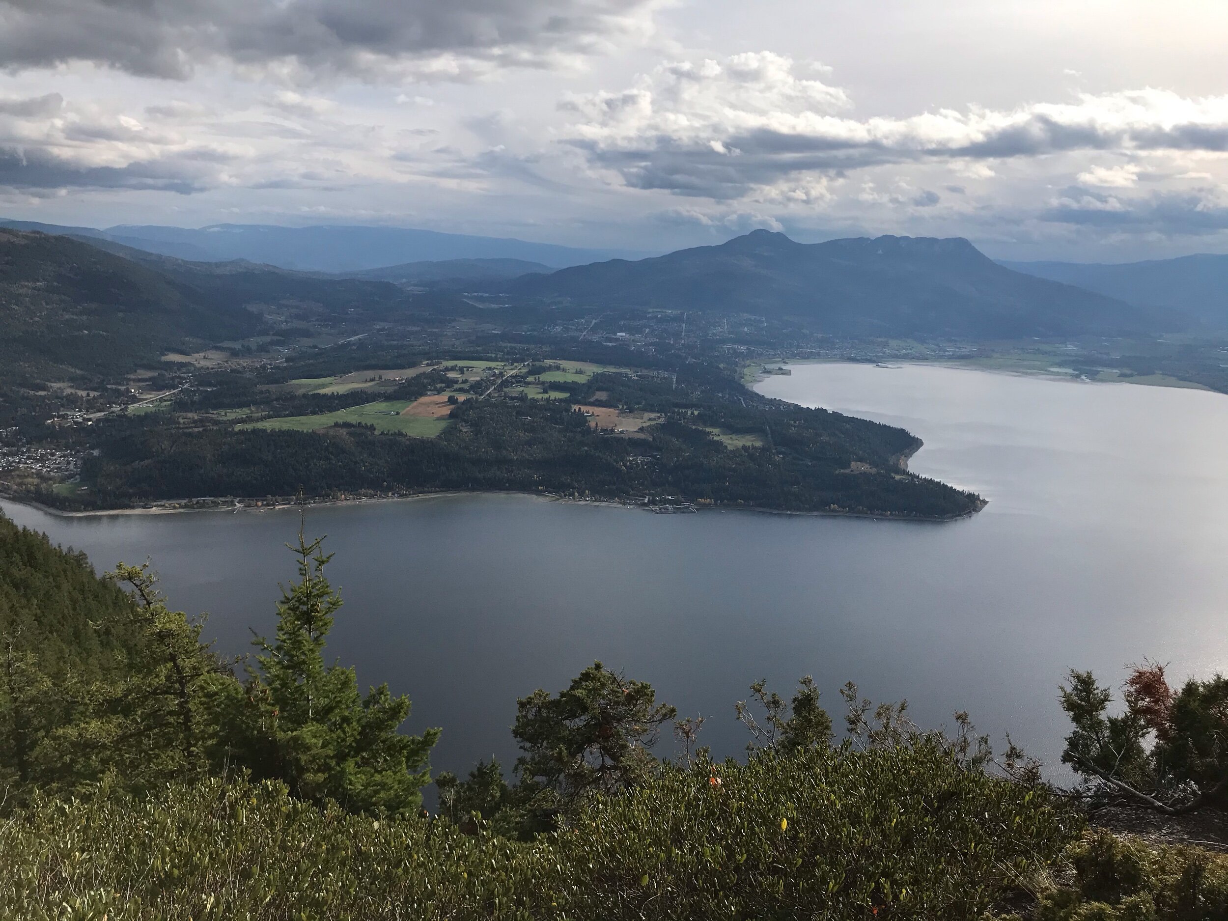
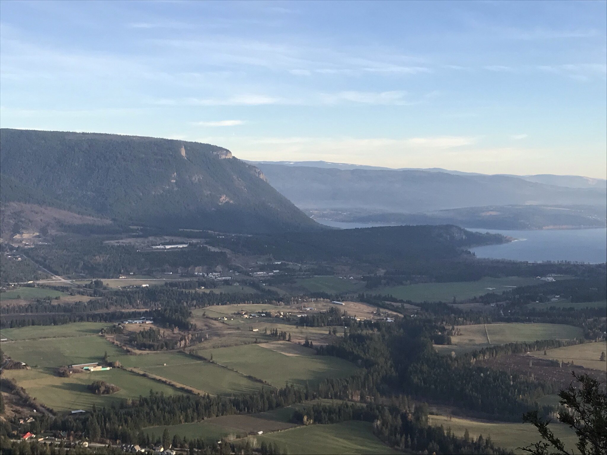
Views over Tappen Bay and onwards to Tappen Valley
Shuswap Adventure Girl
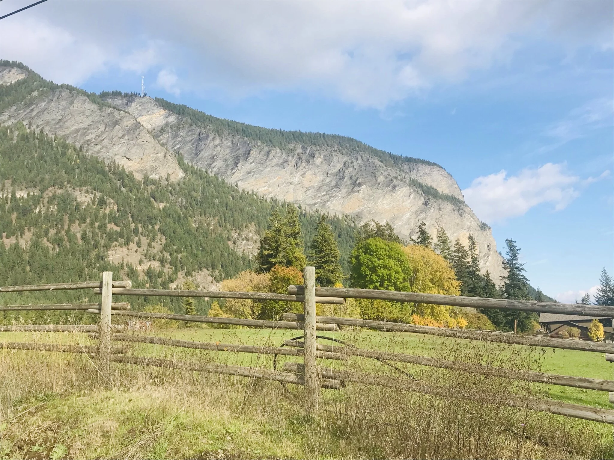
Bastion Mountain is an iconic rock face towering above the north shore of Salmon Arm Bay, made of mostly limestone and shale. The mountain can be seen from so many areas in the Shuswap and is locally loved. People may recognize this mountain as it was previously the image on our old BC driver’s licenses! It was in 1996 that British Columbians’ newly issued driver's licenses featured its new background. It was Bastion Mountain! They selected the locally iconic Bastion Mountain and Shuswap lake image as it was considered to be a challenging background to duplicate or fraud.
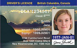
B.C. drivers license featuring Shuswap Lake and Bastion Mountain | photo from https://www.bcpl8s.ca/Drivers-Licences.html
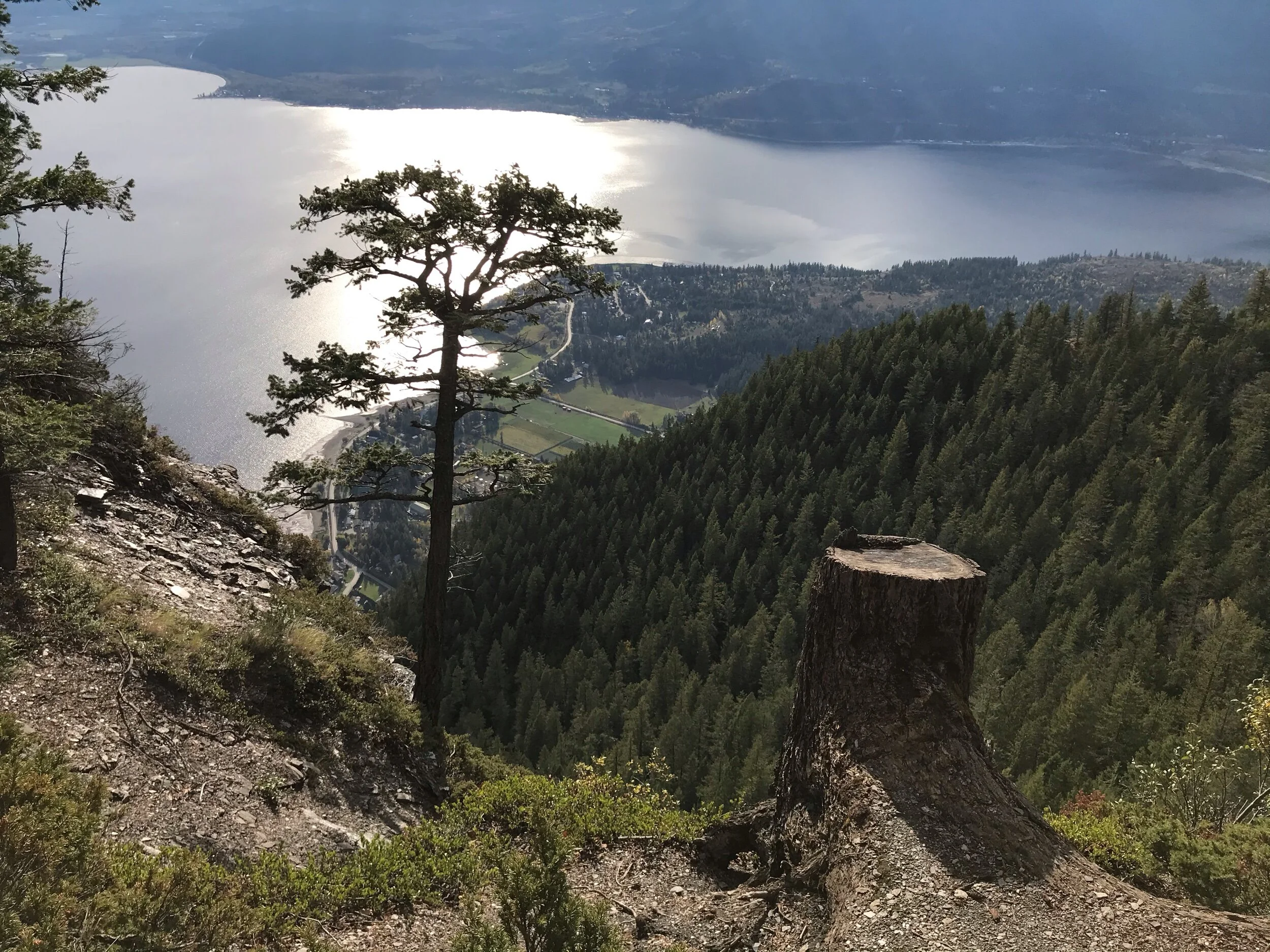
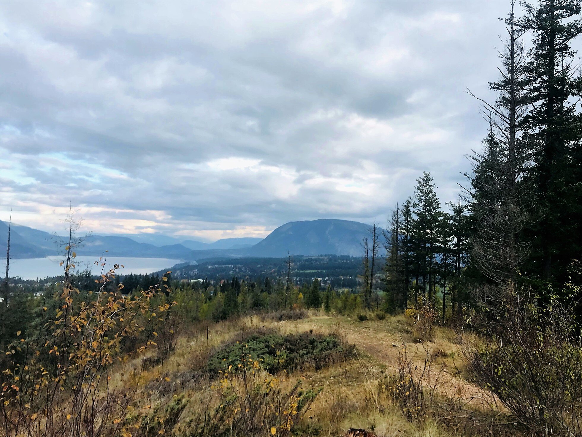
The side profile of Bastion Mountain seen from Tappen Bluffs, Tappen Valley
Shuswap Adventure Girl
Bastion Mountain seen from Little Mountain Parkway Trail in Salmon Arm, B.C.
Shuswap Adventure Girl
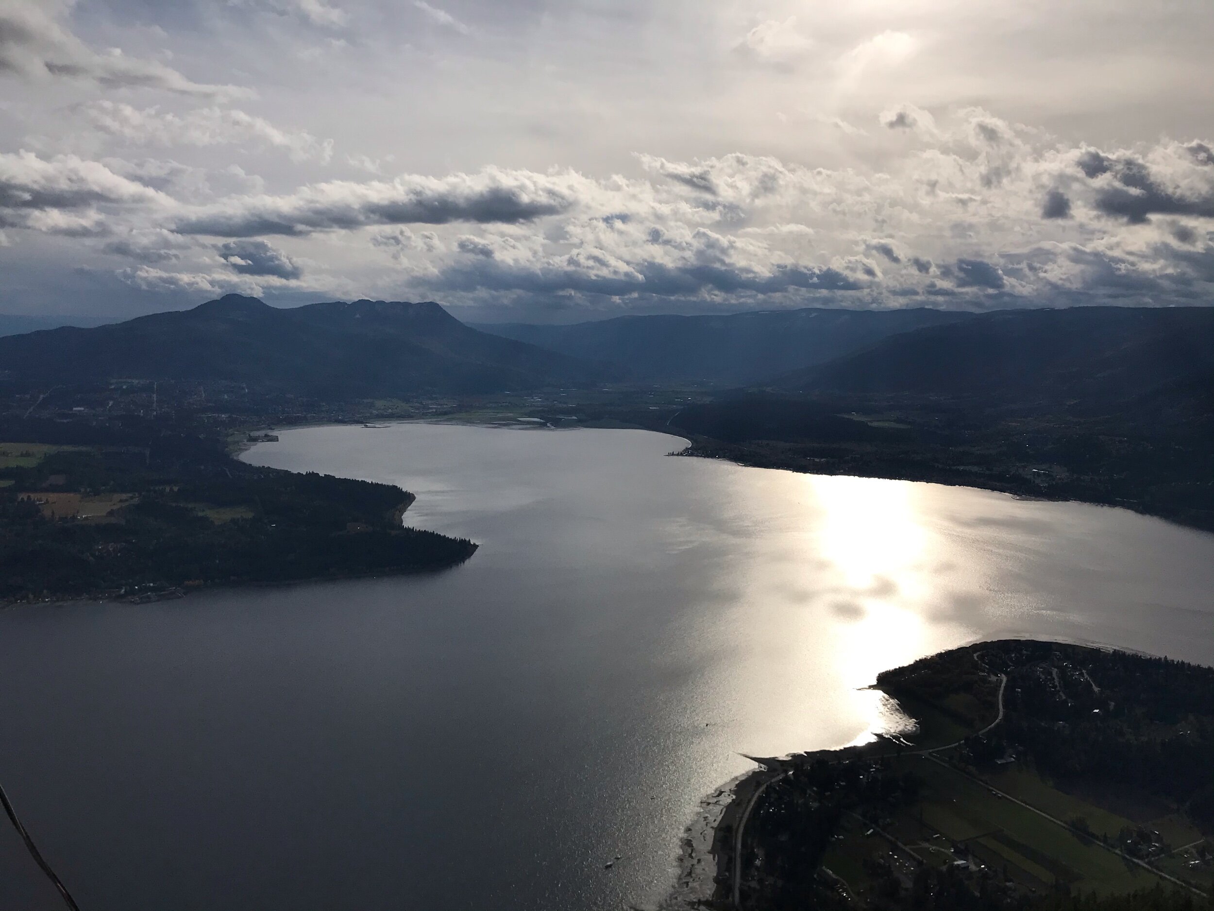
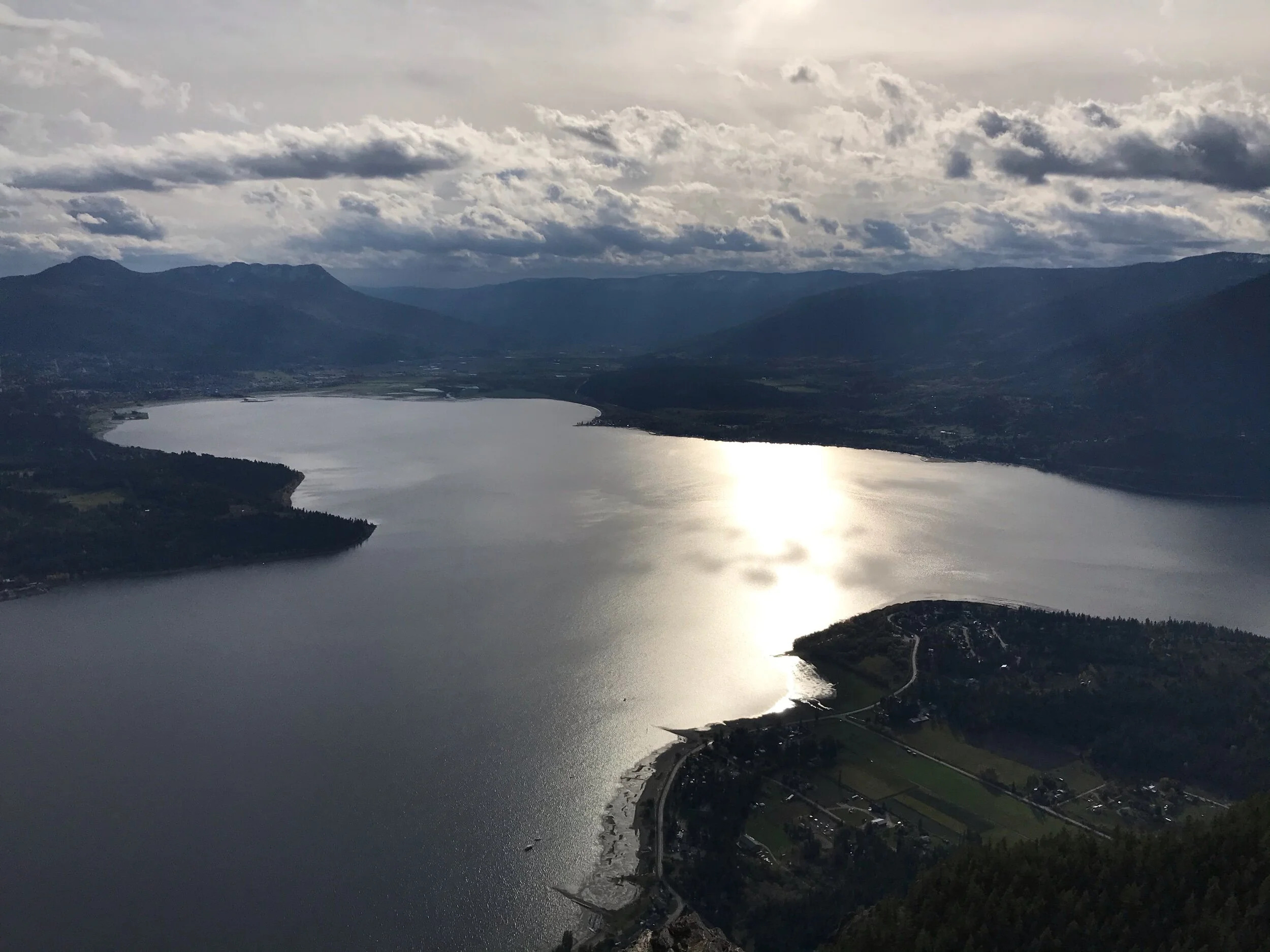
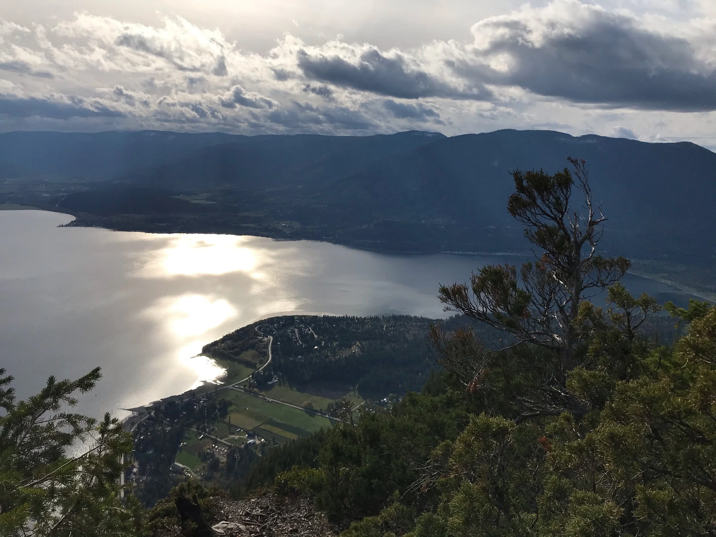
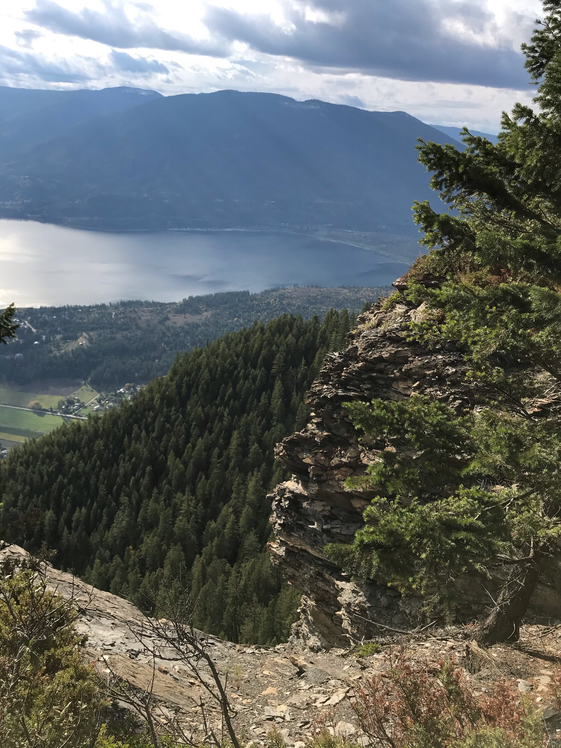
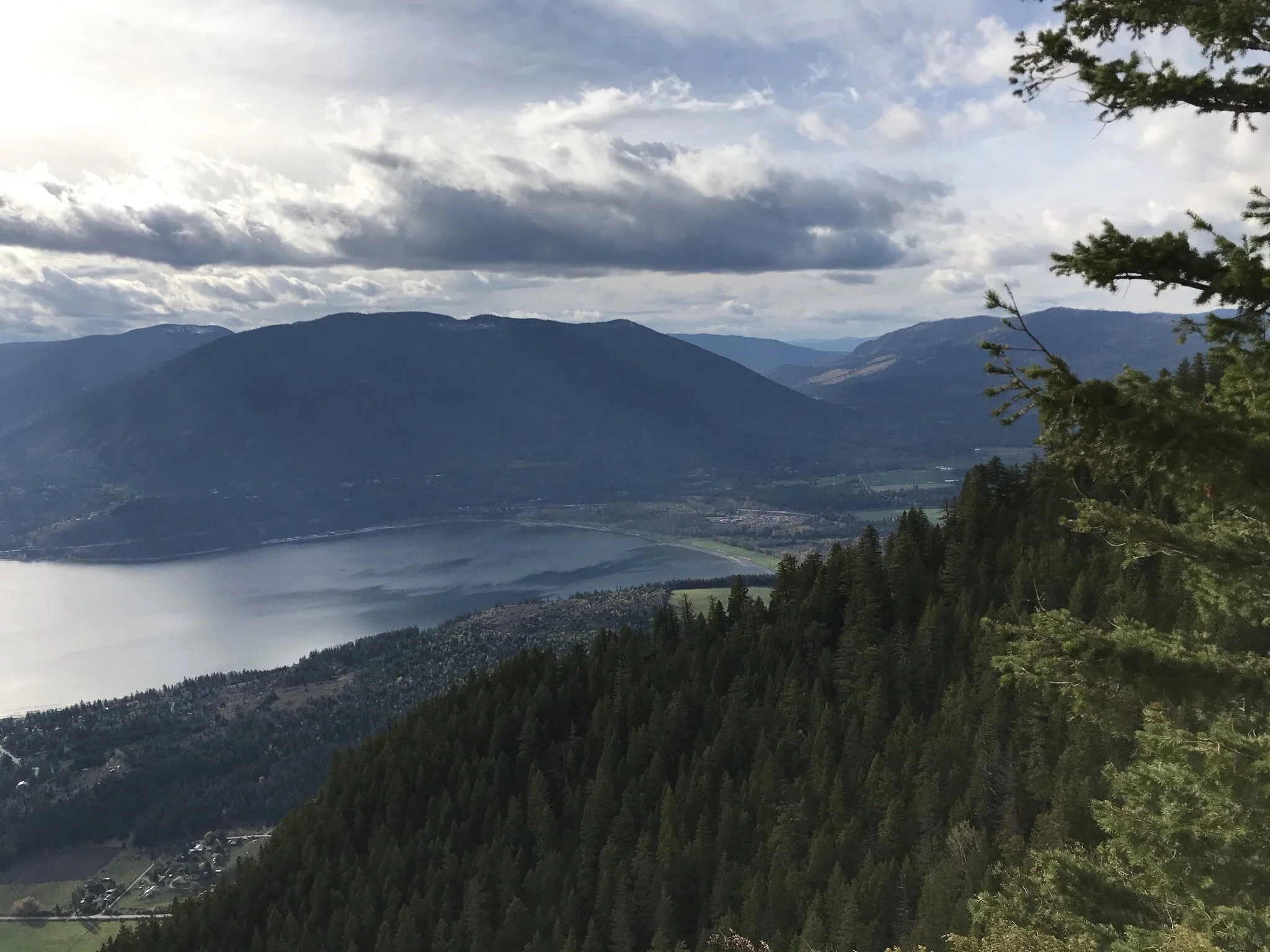
View towards Salmon Arm, Salmon Bay and Mt.Ida, Shuswap lake
Shuswap Adventure Girl
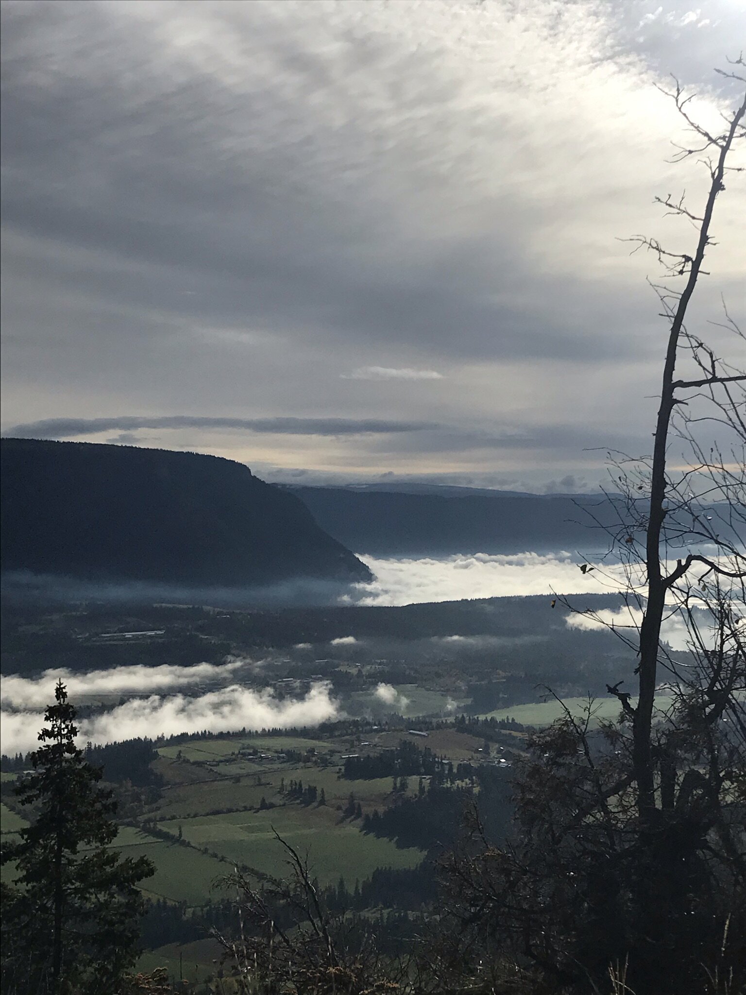
From the lookout, the far-reaching views of Salmon Arm, Salmon Bay, Canoe, Mount Ida, Flyhills, Mt.Tappen, Tappen Bay, Skimikin Valley, and Sunnybrae will keep you happily admiring for some time! An absolutely stunning scene! But be careful, those cliff edges are scary!
Personally, I wouldn’t consider this much of a hike unless you like to climb forest service roads (FSR), however, you can hike a little bit to the viewpoint/radio/cell tower. I have recently heard that there is a trail system from Reinecker Loop Trails to get here but I have yet to try this and I am not 100% sure it is marked.
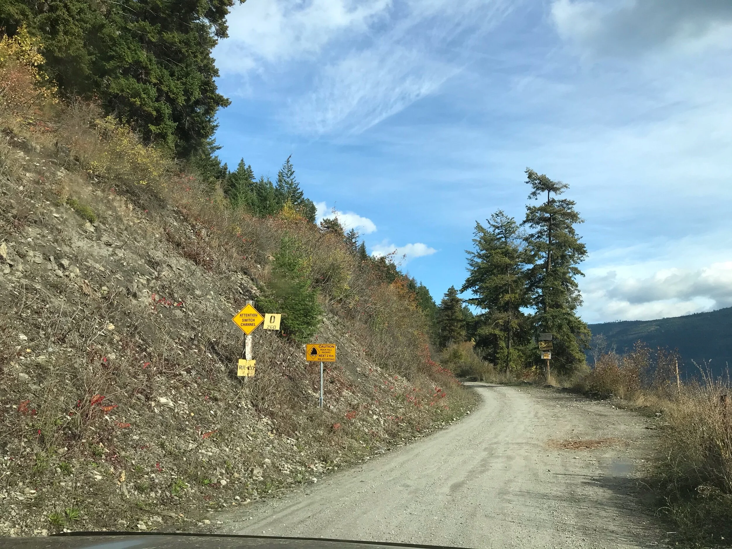
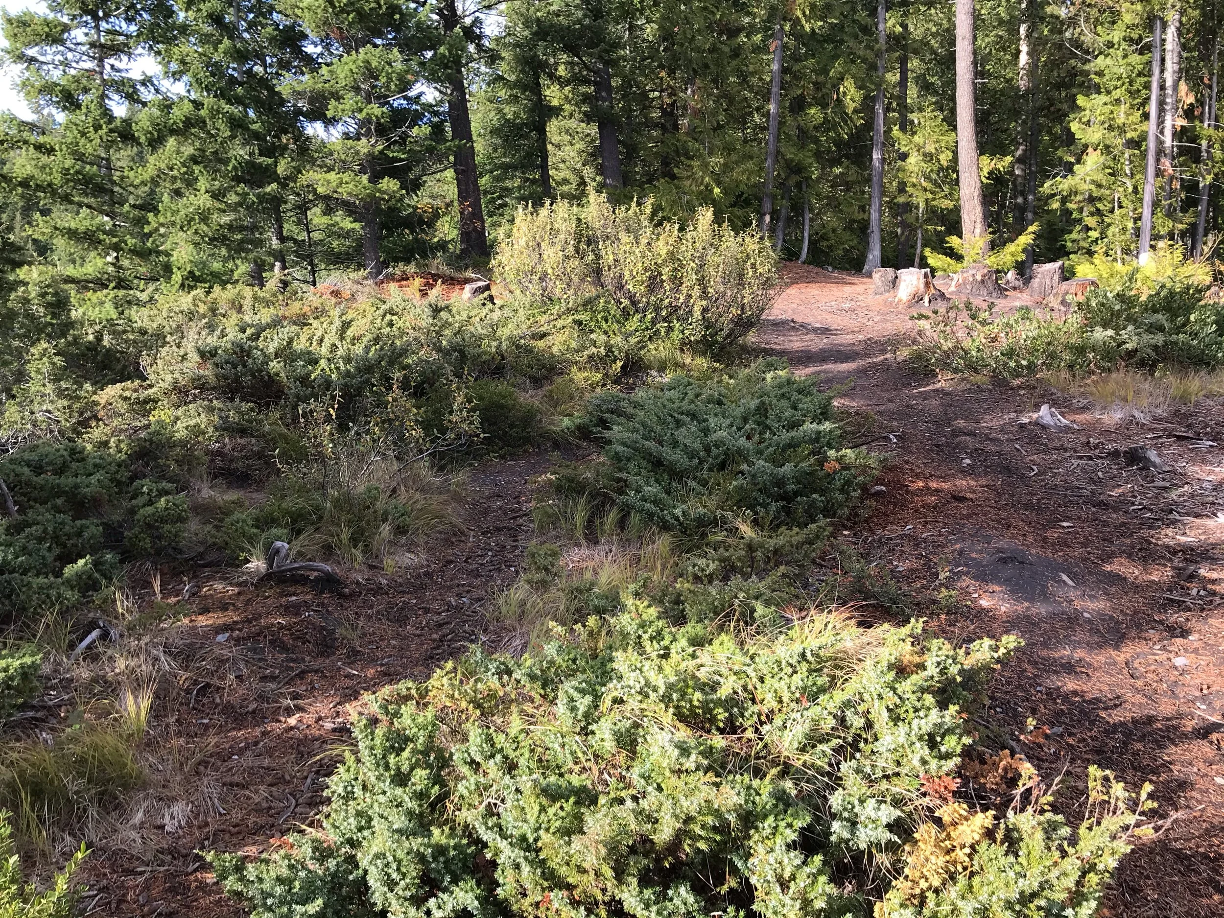
You can drive or ATV up the +/- 11 km rough gravel logging road, plus there is a 1 km walk along the cliffs for great views of Shuswap Lake and surrounding mountains. We drove the entire way up in our 4x4 truck and the last 450m of the trail, which is just past the red gate. I would recommend parking at the red metal open gate if you were in a car and walk the last little bit. The road is muddy!
Once you are at the lookout it is a large open treed area that you can wander around and admire the views. The edges are VERY steep and sometimes hard to see the clear edge under the brush. Keep children way back and within arms reach.
Category: Drive, ATV, hike return
Kid-Friendly: Kids need to have VERY close attention and proximity to adults, edges are extreme and sometimes difficult to navigate. I personally would not recommend kids anywhere close to the edge of the cliffs. We were very nervous as parents here.
Distance: 11km Forest Service road w/ 1 km hike around the top
Directions from Salmon Arm: 15 km west of Salmon Arm on the Trans-Canada or 18 km east from Sorrento turn east onto Sunnybrae-Canoe Point Rd. Follow this road for approx. 6.5 km, turn left onto the rough gravel road marked with yellow logging road signs, leading up to Bastion Mountain. Follow the road up the mountain to the top of the cliffs near the relay tower, keeping to the best traveled main road.